Places of several BKM patriots
When you click on a map, you can zoom and shift to orient yourself to something familiar.
When you go to the links provided, you may use the upper left arrow to return to this page. If there is no upper left back arrow, the link was opened in its own window. You may use alt-tab to keep that window open wile referring back to this window. You may use the upper right red X close button to quit the link.
-
-
- Kings Mountain map.
- National Map
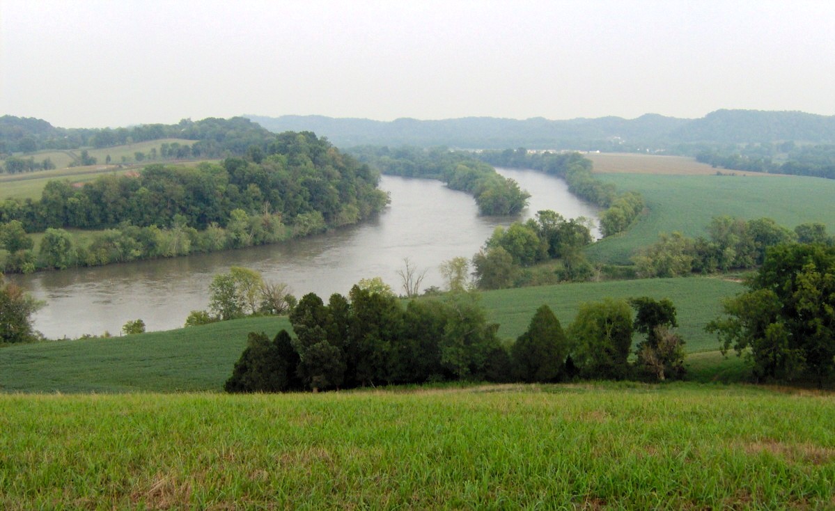
- Cherokee Ford-Broad River map
- Battlefield Chart Thanks, WL Anderson. Lincoln County NC Historical Society
- Kings Mountain drawing, aerial view for 1880 centennial visitors
- WL Anderson’s link to serious Battle Maps
- Cherokee Ford-10 mi to BKM map.
- Alexander’s Ford of Green River 05Oct1780 The scent of Ferguson was in the air, so they rushed on to Cowpens without stopping to see the Carl Sandberg musem while they were in the neighborhood.
- Augusta GA Founded in 1735, at the extent of the navigable Savannah River, in 1780, Augusta had a fort and a Patriot stronghold. It was the second city of the state behind Savannah. By the summer of 1780 Ferguson had the Augusta Patriots rooted out and wandering in Georgia and South Carolina. The Brits controlled Georgia’s two largest cities and much of the countryside. BTW, North Augusta is in South Carolina. Beginning in 1785, Augusta served ten years as the capital of Georgia
- Augusta County VA .
- Bedford’s Hill– On 01 and 02Oct1780 the overmountain volunteers camped near Cowan’s Ford and Cane Creek where the 12Sep1780 battle sent the patriots scattering
- Beverly Manor Peek at Beverly Manor surnames and see many matches with Carolina and Tennessee militia rosters.
Peek at Beverly Manor Map - Biggerstaff’s 14Oct1780 the victorious BKM Patriots camped here (north east of Rutherfordton NC) on their way home. The site is also called Biggerstaff’s Old Fields, Widow Biggerstaff’s, and Red Chimneys. They left three Tory scoundrels hanging when they moved on toward Quaker Meadows.
- Blacks Blockhouse Joseph Black moved from Black’s Fort (Abingdon) about 1785 to build this blockhouse on Crooked Creek along the Warriors Path south of Maryville. In 1795 some Cherokees stole some of his horses. His boyhood friend, General David Logan of the Kentucky militia, threatened to bring an army for revenge. William Blount used the threat to bargain a peace treaty. In 1816, Joseph Black moved north and established a farm on 640 acres straddling the Blount/Sevier county line. His brother, Samuel Newell had moved from Newell’s Station (Seymour), but his sisters Elizabeth Blackburn and Martha Cusick lived near. See the Eusebia map link for thumb tacks.
Blacks Blockhouse Map - Blacks Fort
Muster Ground marker Abingdon . 24Sep1780 near Newell’s improvement on Andrew Colville’s farm at Wolf Creek.
Kings Mountain, Abingdon marker.
Black’s Fort, Abingdon marker. - Black Mountain-Old Fort Ridgecrest at the continental divide between these towns is a short hike from Catawba Falls, headwaters of Catawba River, and from Swannanoa, feeder to the French Girl River. Some of the BKM vets came from here or came here after the battle. Old Fort is also called Davidson’s Fort
- Blue Ridge From northern Virginia, the Blue Ridge passes near Front Royal, Sperryville, Shenandoah, Waynesboro, Bedford CH, and Wytheville. In North Carolina, through Surry, Wilkes, Ridgecrest, and on to Blue Ridge GA
- Borden’s GrantPeek at Borden’s Grant Map
- Boyds Creek. Evans Ferry
When the men came home from BKM, they learned that the Red Coats had incited some of the Cherokees to raid settler cabins while the men were gone. Joseph Martin’s bedwarmer was an Indian princess who told them names and places of the raiders. Many of the BKM pension depositions mention the Battle of Boyds Creek and the excursions to the villages from there. Andrew Evans mentioned Christmas Dinner at Chota. The renegades had scattered. The chiefs came back to deal for the Little River watershed. The patriots would settle in a buffer to stop the Shawnee raiders short of the Cherokee capitol. Evans and other BKM associates came back in 1783 to settle Boyds Creek. He buit a ferry at Buckingham Island where the Warriors” Path crosses the French Broad River. In 1804 Evans sold his farm to John Brabson at Clio. Samuel Newell had the deed recorded in Monticello while he was on Wayne County business.
Boyds Creek-Evans Ferry. - Buffalo Marsh
A creek between Opequon and Cedar Creek in southern Frederick County VA tells us about some sources of strength for the Battle of Kings Mountain. The prior generation of many BKM soldiers began in Frederick county.
Buffalo Marsh map - Buford Gap
One of the routes across the Blue Ridge was at Bufords Gap. It is on Highway 460 between Roanoke and Lynchburg. It was named after four prominent brothers who moved from Culpeper before the revolution. Buford was the Patriot password at the Battle of Kings Mountain. It was chosen not for Bufords of Buford Gap but for their brother Abraham Buford. His battalion was overrun by Tarleton’s regiment at Waxhaw. When they raised the white flag to surrender and laid down their arms, Tarleton kept slaughtering them. Some of the patriots wanted retribution, but Col Campbell had ethics which he enforced and ended the attack when the Red Coats and Tories surrendered. In Culpeper County the original family was Beauford, pronounced the BYoo Ford. In England they were called Beaufort, pronounced almost the same. In France, before they moved to England it was beautiful fort, BeauFort pronounced Bow furt with the soft ending consonant unless followed by a word beginning with a vowel. Henry Somerset, Duke of Beaufort, pronounced his name Byoo Fort. Beaufort SC is named for him and is pronounced Byoo fort, like he spoke his own name. Beaufort NC is named for him and pronounced Bow Fort, the proper French origin. USMC has aair stations near Beaufort and near Beaufort.
Buford Gap Map - Bundy’s powder mills on Holston, was also called King’s Mill. The first settler on Gap Creek was Simeon Bundy, whose house stood near the Big Spring, the head of that stream. Matthew Talbott also lived on Gap Creek, where he built one of the first mills in the State. Another was built at about the same time, perhaps a little before, by Baptist McNabb. Per KK White, “It was on Buffalo Creek near where Alexander Anderson now lives. Charles Robertson lived on Sinking Creek on the farm now owned by Robert Miller. Michael Ryder settled on Powder Branch, about a mile from Watauga, on property still owned by his descendants. James Edens located near Big Spring, on Gap Creek, above Simeon Bundy””
- Burke Courthouse, Morganton NC
Quaker Meadows Marker The old Burke Courthouse was a few miles east of the current Morganton town square. See the Quaker Meadows map from the OVTA places tab. - Burkes Garden North Tazewell, Virginia
- Cane River, aka Caney River, flows from Burnsville NC to the Nolichucky, thence to the French Broad.
- Campbell’s Station – Two years after BKM vet Samuel Newell built Newells Station, now Seymour, in 1783, David Campbell, a BKM vet, built Campbell’s Station at Concord TN in 1785. Also in 1785, John Craig built Fort Craig, now Maryville. In 1786 James White began the fort in the suburbs of Seymour, Maryville, and Concord which became Knoxville. No longer was the 1783 Newells Station the western extent of French Broad River development.
- William Dale Carter
An engineer at Colonial Heights, Kingsport TN who is the ultimate authority of colonial and early American land grants in the Cumberland Gap area. His placement of early forts and roads are taken from land grants, deeds, personal visits to the monuments named, US geo maps, and surveyor mapping tools. You may find some of his published work at Sullivan archives. - Cathey’s Plantation< 28Sep1780. Campbell, Sevier, and Shelby soldiers camped at current Spruce Pine NC where they decided to split into two groups crossing the Blue Ridge at two different gaps. On 29Sep1780, part went over Gillespie Gap to Turkey Cove and the others over Hefner’s Gap to North Cove.
- Cherry Mountain aka Flint Hill, 04Oct1780 Colonels Hill, Lacey, and Williams camped their militia as plans were made in the chase to capture Patrick Ferguson. NE of Rutherfordton in Rutherford Co NC not far east of Biggerstaff’s.
- Chilhowee A mountain Ridge in Blount Co TN. Below the south end on the Little Tennessee River was the Cherokee village of Chilhowee. The town in Smyth Co VA near the Col William Campbell home of Aspenvale is spelled Chilhowie.
- Chota
There were provincial centers of Cherokees in southern Kentucky, western North Carolina, upland South Carolina, and North Georgia. Chotah was the center of centers. The United States sustained an embassy across the river at Tellicao Blockhouse. Before European diseases and war began to decimate the population, some estimate a million were among their nation. Urban sprawl joined the town of Toqua (Vonore Tennessee) to Chota’s suburbs. Edwin Dew, a prosperous trader spoke of his familiarity with Notchy Creek which runs down to the Little T from the Madisonville area. Chota was the place for Pow Wows among the chiefs and between the chiefs and the leaders of other nations; France, Spain, England, Shawnee, Creek, Chickasaw, and a fledgling United States. Many of the BKM pensions mention Chota, Boyds Creek, South of the French Broad, Tennessee River, or Little Tennessee where the soldiers had a brief rest in November 1780, then another series of battles and punitive skirmishes in December and January 1781.
Chota map. - Christian’s Fort – brother in law of Patrick Henry, William Christian moved from Montgomery County Virginia with Anne Henry Christian in 1785. They settled on land granted in payment for military service in a part of old Fincastle County (whose resolutions he signed) now in St. Matthews, Jefferson County, KY. See Falls of Ohio
- Clio KY
Samuel Newell moved from Boyds Creek to Clio in 1797. The Clio Post Office was across the road from current Raintree Inn - Clio KY map.
My best guess from childhood memory for location of old Newell cemetery covered by Lake Cumberland.
Newell Family Graves, Markers moved to Pisgah map - Cowpens 06Oct1780 some remnants of Sumter’s army and various other strays along with Col Williams reorganized corps from Hillsborough joined here with the Cambell, Cleveland, Shelby, Sevier corps. Col McDowell left to get the SC Governor to appoint a general for the army of over 2000. Capt Colville “requisitioned” some Tory beef for a pre-game tailgate party. Then a scout got a fresh scent of Ferguson and Campbell called on over 900 of the best horsemen to go immediately to Cherokee Ford. The footmen followed.
Cherokee Ford-15 mi to Cowpens map - Cranks Gap
When the traffic on the Kentucky Road through Cumberland Gap was jammed, an alternative route was Cranks Gap. It is NE of Cuttawa. I presume that it was named for John Crank of Russell Co VA who was a scout around the Kentucky Road with Samuel Newell. Samuel Newell cashed part of his treasury warrant from the Battle of Kings Mountain to buy 426 acres on the Virginia Side on Cain Creek. It had been split from Washington into Lee County when he sold it.
Cranks Gap map. - Crider’s Fort is mentioned (Krider’s Grider’s) in various pension declarations. It was where the current town of Lenoir NC is located.
- Crooked Creek Across Little River from Ellejoy, Hugh Weir and Joseph Black from BKM settled on Crooked Creek. Per the 25Dec1780 agreement at Chota, they were part of the white man’s defense for the Cherokees against Shawnee raids from the north coming down the Warriors’ Path.
- Cusick
Cusick TN SE of Newell Station map.
BKM veteran and brother in law of Samuel Newell, moved across the knobs from Newells Station. - Cuttawa – Cuttawa is the Indian name for Cumberland Gap. The Cherokees have yet to rename it like we did.
- Davidson’s Fort at the head of Catawba (see Black Mountain-Old Fort NC)
- Doe River – also called Shelving Rock.
The overmountain expedition camped near current Roan Mountain TN State Park on 26Sep1780.
Doe River and Roan Mountain were mentioned in several veterans’ pension declarations. - Ebbing Spring Ebbing Spring map link.
- Note that another ongoing church took the name “Ebbing Spring Church.” It is downstream on DeBusk Mill Road.
-
Link to Ebbing Spring article
Ebbing Spring pages
-
-
- Ellejoy – A large Cherokee settlement on the Warriors’ Path north of Little River was a defense against Shawnee raiders. After Christmas Dinner at Chota, the Cherokees evacuated a large village at Ellejoy and some smaller Tuckaleechee villages up stream. They entrusted their defense from Shawnee attack to the BKM boys who agreed to settle there.
Ellejoy map - Eusebia– The Presbyterian Church on land south of Newells Station contributed by the Bogles. Some of Newell’s relatives and likely his parents are buried there among several (15-20) veterans of The Revolution.
Eusebia map. - Eutaw Springs 08Sep1781 General Nathaniel Greene wanted to clear the British presence from upland South Carolina. Their stronghold at Ninety Six was under siege by the patriots and important enough to draw out a red coat force from Charleston. The Battle at Ewtaw Springs on the Santee River was mentioned by a number of the BKM vets. Several county clerks spelled it Utah, but they were not really that far west. You folks from Eighty Four, Pennsylvania were a dozen shy. Eighty Eight, Kentucky and Seventy Six, Kentucky also come short of 96, but not so much as Fifty-Six, Arkansas.
Hundred, West Virginia wins by four bucks (or four fingers?).
Ewtaw Springs Battle - Evans Ferry In 1783, Andrew Evans moved to the French Broad where he built a ferry below Buckingham Island where the Warriors’ Path crosses. In 1804 he sold the farm and the ferry to John Brabson.
French Broad pic
The Brabson’s preserved the Evans cabin.
Evans Cabin pic
The Brabson Ferry was the subject of a picture post card.
Brabson Ferry
Up the great path from the south end of the ferry in sight of Newells Station is this marker.
Warriors’ Path marker on Chapman Highway at Boyds Creek in Seymour TN. - Falls of Ohio – Christian’s Fort – Fort Jefferson. Col William Christian moved from Fincastle County upstream from the falls of the Ohio River with his wife (Patrick Henry’s sister). From his fort, the Old Dominion had a presence nearer to the center of their domain. After using the Falls of the Ohio as a mustering ground, Goerge Rogers Clark and William Henry Harrison set up at Vincennes farther northwest. Reference to these locations is seen in the pension depositions of BKM veterans. A hospital nearby was the birthplace of your faithful obedient servant.
The Falls City of Portland was incorporated into Louisville (Loo ee ville) to honor the king of France in Jefferson County to honor our 3rd president. The Portland Canal gave boat traffic a way around the falls but activity at the Ohio River port grew on both sides of the river.
The Natchez Trace grew to the south passing the Cumberland near Nashville as the overland alternative to the river. - Fancy Gap – Today at the point where Interstate 77 (actually US52) crosses the Blue Ridge between Wytheville VA and Mt Airy NC, Fancy Gap was in 1780 the place where bullets from the Fort Chiswell lead mines crossed the Blue Ridge to the patriots at Salisbury. Guards were posted sometimes at Fancy Gap but more often instead at Fort Chiswell since Volunteer Gap east of Fancy Gap at the Carroll County/Patrick County line Wards Gap, Orchard Gap, and to the east, Piper Gap, among others, offered more than one approach for an attack on the mines. If you read of Flower Gap or Flour Gap in a BKM pension declaration, the soldier was probably speaking of the point where US 52 crosses the Blue Ridge. Fancy Gap map.
- Fincastle County 1772-1776 was split off from Botetourt County to contain SW VA, Kentucky, and part of WV. Lord Fincastle lost popularity during the revolution and hsi name disappeared with the split of the county except for the town which became county seat of Botetourt County.
Fincastle County marker - Flint Hill See Cherry Mountain
- Flower Gap – Flower Gap North Carolina is NW of the Blue Ridge west of Hendersonville. Flower Gap Virginia is north of Rogersville Tennessee about half way between Long Island of the Holston (Kingsport) and Cuttawa (Cumberland Gap). Flower Gap Road in Cana Virginia runs from Old Piper Gap Road to Fancy Gap Highway. Flower Gap (flour gap) was in 1780, the name of today’s Fancy Gap.
- Fort Chiswell Read details in the Augusta County page link above.
Shot Tower Historical Marker/a>
Fort “Chisum” map.
New River Lead Mine map.
Lead Mine sattelite view. - Fort Crider, Lenoir NC 29Sep1780 The Wilkes/Surry corps under Col Cleveland encamped the day before meeting the overmountain vols at Quaker Meadow the next day. (aka Krider, aka Grider).
- Fort Loudoun
1756-1760 near Vonore TN, reconstructed to scale with identical materials 1934. Dismantled, elevated with fill dirt, and rebuilt above the elevation of Tellico Lake 1965. Fort Loudoun was also the name of other frontier forts including George Washington’s Winchester VA fort in the precinct of Samuel 1713 Newell. I didn’t swim in the Little T when I was little. Mr. Niles wanted a toll for his ferry and so did the US411 bridge. After they took the toll off, I enjoyed swinging out on the wild grape vines on the bluff downstream from old Fort Loudoun. I don’t think anyone kept a video of those beautiful dives. Maybe somebody has a still shot. - Fort Loudoun map
- Fractionville – Between Blacks Fort and Wyndale Station on Wolf Creek upstream from the Muster Ground where the Vols rallied to begin their trip to trap Ferguson.
- Frederick County VA
- Front Royal VA
Lehewtown or Helltown were early names for Front Royal which became the name of the County Seat of Warren County VA in 1788. Origin could be le front royal, French name for the frontier of the royal colony of Virginia. The west fork of the Shenandoah River flows around the NE end of the west spur of the Blue Ridge below Strasburg and joins the west fork at Front Royal. The area is the northern entrance to Skyline Drive and the site of Shenandoah National Park and various Civil War monuments. The lower elevation east spur of the Blue Ridge continues NE to the Potomac. - Gaffney SC Col (or Gen) James Williams body was taken from the battlefield on a Tory or Red Coat wagon converted to hearse. He was buried at current Gaffney SC.
- Gilbert Town 04Oct1780 The overmountain men camped here north of Rutherfordton NC.
- Glade-Spring-VA
- Greasy Cove-Erwin Tennessee
Greasy Cove of Nolichucky. - Greenlee’s Ford– The Catawba River crossing at Quaker Meadows (Morganton, NC) used by the Kings Mountain expedition both to and from the battle. The neighborhood in which Doctor Joseph Dobson cared for patriots wounded at Kings Mountain.
- Guilford Courthouse, Greensboro, NC, 1781 Battle between forces of American General Nathaniel Greene and British Lord Cornwallis.
- Hanging Rock
- Haws Meadows
- Hefner Gap/Gillespie Gap 29Sep1780 where Vols split and crossed the Blue Ridge in two groups.- Southeast of Spruce Pine NC. Hefner’s Gap to North Cove and Gillespie Gap to Turkey Cove. They joined again at Quaker Meadow (Morganton) on 30Sep1780.
A little walk around Hefner Gap - Hillsborough was the capital of NC during BKM. It moved here from New Bern and later ultimately to Raleigh. The aborted State of Franklin communicated with the NC General Assembly at Tarboro. The General Assembly rotated among town to meet in different communities including Fayetteville. After the defeat of the South Carolina army at Camden, Gen Gates fled to Hillsborough. Later Col Williams came to Hillsborough to reform the SC militia with NC and VA fill-ins and pursue Major Ferguson.
- Hungry Mother– Isaac Roman and Andrew Evans came to BKM muster from the Hungry Mother community north of Marion VA.
- Indian Knob – The highest point of the Kings Mountain Battlefield where the action began at the southwest end.
- Kanawha – The Indian name for the northern part of New River in West Virginia.
- Kings Mountain – Sunday 08Oct1780 memorial services for the Patriots killed in the battle.
- Lead mines of New Rover- See the Augusta County section.
- Lincoln County– Formed from old Tryon County when the “New Acquisition” of South Carolina was taken from the area SW of Charlotte, Mecklenburg County. Lincoln County NC and York District of SC were the nearest to the Battle of Kings Mountain. The Battle at Ramsours Mill (Lincolnton) was fought in Lincoln County in the summer before BKM. Ferguson reacted to this defeat of the Tories driving Whigs of Sumter’s remnant, Augusta Georgia remnant, and McDowell’s Burke County militia over the mountain to Watauga. The Lincoln County “South Fork boys” were scattered by Ferguson.
- Little York- frequent nick name for York Town, the site of Cornwallis’ surrender
- Logan’s Fort– Benjamin Logan grew up on Buffalo Marsh Run with Joseph Black. He moved to Beaver Creek downstream from Samuel 1713 Newell’s claim in 1772. He moved through Cumberland Gap to build his fort at St. Asaph (current Stanford KY) then the westernmost settlement of Fincastle County, later Lincoln Co KY. His fort became Stanford, the county seat of Lincoln County.
- Long Island of the Holston was the site of a battle against Indians and of treaties with the Indians. It was the site of Fort Patrick Henry. Now it is named Kingsport TN
- Maiden Fort – The fort at Maiden Spring in Tazewell County Virginia was the home station for Captain Charles Bowen’s militia company.
- Maiden Spring map.
- Marlin’s Knob – 03Oct1780 the overmountain men camped here.
- Martin’s Station– Joseph Martin’s home on the Powell River east of Cumberland Gap.
- Mecklenburg County – Cornwallis occupied Charlotte in Mecklenburg County NC with his army at the time of BKM.
- Moravian Towns
- Mulberry Fields Wikesboro Keowee
- Mulberry Gap
Mulberry Gap VA-TN map.
Samuel Newell cashed part of his treasury warrant received in lieu of cash payment for military service to buy Mulberry Gap at Walker’s Old Line. The Lee County deed was part of Squabble State, the strip between various surveys of the VA-NC border. - Muster Ground
- Newell Station
Newell Station map.
Elizabeth Blackburn, Newell’s sister and widow of BKM veteran Wm Blackburn moved from Spring Creek (current Highlands Airport, Abingdon) to the tract across the road from where Harrison Chilhowee Baptist Academy was built.
Sisters Ann Montgomery McCroskey and Jane Montgomery Newell lived on adjacent tracts on Boyds Creek.
Newell’s Station marker. - New Providence Presbyterian Meeting Place- Just inside Rockbridge County VA from Augusta Co, this church was built by the families in the Borden Grant in 1746. Anderson, Beatty, Berry, Lusk, Houston, McCroskey, and McCutcheon family names are among BKM veterans. Jane Montgomery Newell’s mother was among the girls who carried sand from a river eight miles away so the men could continue their work and have cement without disruption to the building project. This congregation is the likely source of the name for the church in Maryville, Tennessee.
- Ninety Six -The South Carolina district between Columbia and Augusta. The town of 96 was also called Cambridge. The district was also called Craven District. Laurens District was formed from subdividing ninety six. Why didn’t they call it forty eight?
- Offset Tennessee -Find Offset on a map, then back off to view the result of Henderson and Walker’s survey squabble.
Offset TN map. - Opequon– The community on the creek south of Winchester VA was the origin of various BKM veterans. Vance, Newell, Blackburn, Colville, and Blacks came from Opequon and Cedar Creek area.
- Orange
In 1732, Spotsylvania County (Fredericksburg) was split with Orange County (courthouse in the town of Orange) formed to the northeast containing all the land in the Colony of Virginia to the west and north. James Madison Sr’s plantation in Orange County was called Mount Pleasant, perhaps from its view of the Blue Ridge to the northwest. The plantation was renamed to Montpelier so the French diplomat could say Mount Pleasant. - Overmountain Trail
- Paperville- The community of Evan Shelby’s plantation east of Sapling Grove was later named Paperville, then Bristol. Everyone thought it to be in the domain of The Old Dominion. Evan represented his precinct in the Fincastle Resolutions. Isaac Shelby represented the area in the county commission of both Washington Co VA and Washington Co NC.
- Patton’s Grant to James Patton 120,000 acre grant west of the Blue Ridge, 1738, Blacksburg VA area.
Patton’s Grant - Point Isabel- A trading ground and athletic competition center for the Cherokee and Shawnee meeting at the confluence of the Cumberland River and Big South Fork. In steamboat days, it was the last stop in the packet boat route up the river from Nashville. One of the paddle wheelers was named Isabel. The port was renamed to Burnside KY after the Civil War. It was the site of a toll bridge and tunnel on US27. It was submerged by the closure of Wolf Creek Dam forming Lake Cumberland.
- Point Pleasant Battle against Shawnees near Ohio and New River confluence referenced in several depositions by Kings Mountain participants.
- Pulaski
- Quaker Meadows 30Sep1780, the split volunteers rejoined at McDhowell’s plantation at Quaker Meadows (Morganton NC). Cleveland’s corps and some stray Burke County militia joined the Watauga expedition. On the return trip from Kings Mountain several wounded patriots were spread among Quaker Meadows farm houses where Dr. Dobson made the rounds to treat them. See the Burke County reference.
NPS Overmountain Trail Click the “View Park Map” button. - Ramsour’s Mill 13Jun1780
Ramsour’s Mill Lincolnton NC
Ramsour’s Mill pic - Red House was a Presbyterian Church neat Milton NC (Danville VA). Cornwallis occupied it or its parsonage for a while in 1780. Col. Becknell attacked him there. http://revwarapps.org/s16343.pdf http://revwarapps.org/w8399.pdf
- Red House, now Haymarket near Manassas VA was a muster ground during the Revolution. http://revwarapps.org/s7376.pdf
- Red House on Staunton River was a munitions store.http://revwarapps.org/s32169.pdf
- Reed Creek – Wytheville/Fort Chiswell see the Augusta Co VA or Fort Chiswell entries
- Reedy Creek was the name for the area near Long Island, Kingsport TN, the Fort renamed to Fort Patrick Henry, the place where the Warriors’ Path crosses the Holston River, across the river from the place where historical cartographer supreme, William Dale Carter, resides.
Reedy Creek-Long Island. - Rye Cove NW of Kingsport in Scott Co VA -need to fix map point
Reedy Creek-Long Island. - Salisbury – Rowan Co NC. Some of the BKM troops, especially Col Williams corps returned to Hillsborough via Salisbury. By some accounts, the Red Coat prisoners were split from the Tories with the Red Coats taken to Salisbury and the Tories primarily to Bethabara and Old Salem. They were probably confused with a patriot excursion into Charlotte after Cornwallis evacuated due to BKM. Several abandoned sick and wounded Red Coats were captured and taken to Salisbury. There was only one red coat at Kings Mountain but Ferguson left it in his tent. Several of the wounded BKM patriots were taken to Salisbury for treatment by Dr Frederick Fisher and others.
Salisbury between BKM and Hillsborough map. - Sapling Grove – the original name for Bristol in the Sqabble State.
- Shallow Ford of Yadkin See Wilkes County
- Sinking Spring was the name for the Wolf Hill subdivision area when the Presbyterian meeting place was established. Blacks Fort was the new name when it became the county seat. It was renamed again to Abingdon to honor Martha Washington. A prominent feature of Abingdon is the Sinking Spring Cemetery. The Sinking Spring Presbyterian Church building has twice been replaced, first moving to the current Barter Theater site, then to the current location closer to the courthouse.
- Smith Shoals
Between Cumberland Falls and the confluence of the Big South Fork, the rapids at Smith Shoals in Pulaski County KY did not make the river unnavigable. Determined engineers built a wall to divert the water to a channel. The great shipwreck of 1876 dumped barges of coal into the Cumberland River. The shipwreck made it unnavigable but level 5 canoes and kayakers didn’t get the word. - Sperryville, Virginia
Sperryville is in Rappahannock County on US 211 (Lee Highway) between Warrenton of Fauquier County and Luray in Page County. It is the Junction of Lee Highway with Zachary Taylor Highway (US 522) from Culpeper to Front Royal. Rappahannock county seat is Washington VA (Little Washington). - Spotsylvania
In 1720, Spotsylvania County (Fredericksburg) was split off from Essex County with the land in the Colony of Virginia largely unexplored and unmapped to the west and north. - Squabble State – Mentioned in various pension declarations in the veteran’s honest attempt to answer under oath. The feds asked place of residence at time of entry into military service. The lived in a strip roughly three miles wide between multiple survey lines on the border between NC and VA. Two decades later, John Sevier was in the field with surveyors and kept a diary. On one day’s entry he said that they had located and marked 36-30. On the next day’s entry he said that they located and marked 36-30 about a half mile from the day before. He failed to say whether it was a zip or a zag. Thirty six degrees and thirty minutes or 36.50000 degrees latitude was the agreed boundary with permission to vary for good cause, such as Cumberland Gap. On one of your map peeks, center up on the state line, then look for 36.50000 on the latitude inset box.
- St Asaph – See Logan’s Fort
Stalnaker’s– Samuel Stalnaker was a longhunter, an Indian trader, and one of the earliest settlers in the Holston Valley. Dr. Thomas Walker met him at his camp near present Kingsport TN on Reedy Creek in April 1748. Stalnaker advised Walker’s expedition about Cuttawa and agreed to be their guide on a future trip. In 1750 Walker started another expedition. In March they found Stalnaker near his hunting camp and helped him complete building his new cabin. It became a point of reckoning for frontier travelers for the next two decades.
Stephens Fort – - Straight Creek -Near the Cumberland, on the Kentucky Road, Pimeville KY, where William McBride and Samuel Newell camped. 1781-1782.
Straight Creek map - Surry County NC- provided some of the militia troops who joined with Wilkes County militia under Col Benjamin Cleveland for the Kings Mountain campaign.
- Ellejoy – A large Cherokee settlement on the Warriors’ Path north of Little River was a defense against Shawnee raiders. After Christmas Dinner at Chota, the Cherokees evacuated a large village at Ellejoy and some smaller Tuckaleechee villages up stream. They entrusted their defense from Shawnee attack to the BKM boys who agreed to settle there.
-
- Sycamore Shoals Muster
- Sycamore Shoals 25Sep1780 – also Watauga Shoals, Elizabethton TN. The second muster 25Sep1780 where the Blacks Fort and Long Island boys met with the Greasy Cove volunteers and the refugees from Georgia, South Carolina, and North Carolina.. See an artists rendition on the Books tab of SN1754.com. Rev. Samuel Doak of Liberty Hall Academy (Col Campbell’s alma mater) presented a spine tingling sermon and benediction. The NC, SC, GA women and children were sheltered at Watauga homes while their healthy men who were reinvigorated joined Campbell, Shelby, and Sevier’s troops to head over Yellow Mountain.
wield the sword of the Lord and Gideon. AMEN - Tate’s Plantation – A mile below Buffalo Creek, Ferguson’s corps camped on 05Oct1780. On the morning of 07Sep, the Patriots went on downstream to cross so that they would be clear from attack if the Tories were still around their camp.
- Tellico Blockhouse
Tellico Blockhouse map the US embassy to the Cherokee nation across the Little Tennessee River from Chota. - Tinkling Spring – The Augusta County Presbyterian meeting place where some of the BKM veterans originated./li>
- Tory Oak The tree in Wilkesboro on which five Tories were hung. 27Sep1780. The Wilkes/Surry corps encamped here.
- Touristville On the south side of the Cumberland River in Wayne County KY, the northern center for the Cherokees was a defense against Shawnees coming from the north. Tousistville is downstream from Samuel Newell’s farm at Clio KY. Long hunters from Fort Chiswell made a camp nearby near Mill Springs. The land was granted to George Rogers Clark and was called Price’s Meadow. Many of the Cherokees moved to Tellico allowing white settlers to be their buffer from Shawnees. Chief Dragging Canoe was one who moved. He proceeded to profit from three sides, from the USA with his treaty, from British agents to violate his treaaty, and from settlers’ possessions Which his braves brought him.
- Tryon County comprised all of North and South Carolina west of Charlotte until the New acquisition District of SC and Rutherford County NC were formed. Unpopular Royal Governor Tryon at New Bern had his name erased from the maps.
- Volunteer Gap
Volunteer Gap east of Fancy Gap VA is on the Blue Ridge Parkway at the Carroll County/Patrick County line. It is east of I77 between Mt Airy NC and Wytheville VA. This was near the route from Surry County to the Fort Chiswell lead mines thus a place where Tory attackers might pass.
Volunteer Gap map. - Walker’s Old Line– Dr. Joseph Walker of Virginia, credited with the first map of Kentucky territory, represented his state in surveying the line with North Carolina west of the Blue Ridge. His line was one of several lines until Tennessee, Kentucky, and Virginia agreed decades later. An interesting read is the war of State Street in downtown Bristol.
- Watauga Shoals aka Sycamore shoals
- Yellow Mountain map
- West Augusta The West Augusta District of Virginia was influenced more by Winchester and Frederick County than by Staunton. It was split into Monongahala, Yohogania, and Ohio counties. Another Samuel Newell, son of SN1754’s uncle William Newell, was Yohogania county judge at Fort Pitt, now Pittsburg. Several Frederick County VA Newell cousins were involved aound Fort Pitt in the preparations for the George Rogers Clark expedition. The agreement to square up western Pennsylvania, with Erie on the lake, took Fort Pitt and Yohogania County away from Virginia.
- Whites Fort- With protection from Campbell’s Station and Newell Station on the flanks, James White built a fort in the middle. William Blount, First Presbyterian, and Samuel Carrick’s little school were in the neighborhood by 1794. Whites Fort didn’t grow, but Carrick’s college did, now the University of Tennessee.
- Whitwell’s Mill
- Wilkes County
The Shallow Ford of the Yadkin in old Wilkes County is now on the Forsyth and Yadkin County boundary. Several soldiers mention it in their pension declarations. On14Oct1780, a week after the Battle of Kings Mountain, a Tory force was defeated by Patriots from Montgomery County Virginia under Major Joseph Cloyd in a battle at Shallow Ford.
Shallow Ford map.
Shallow Ford marker. - Wolf Hill – the tract named by Dr Thomas Walker of the Loyal Land Company because Daniel Boone slept there near the wolves. After he subdivided and sold, it was renamed to Blacks Fort, later to Abingdon VA. Henderson, Pendleton, Walker, and other eastern land speculators shoed contempt for the Proclamation of 1763 by reducing lines with the square root of two. They made papers showing the royal governor on paper, half the size of land they marked on the ground.
- Yellow Mountain crossed 27Sep1780 on the way to find Ferguson.
- York District – The South Carolina county in which the Battle of Kings Mountain was fought.
- Zane’s Iron Works
For a period of time, Izaac Zane was the largest employer in old Frederick County Virginia. His early land holdings grew from the Samuel 1713 Newell Cedar Creek tract which straddles the current boundary of Shenandoah and Frederick Counties. There are mentions of Zane’s Iron Works in BKM pension declarations. Wagon wheel rims and horse shoes were part of the equipment required to wage a successful war, so military commanders kept their eye on guarding this critical area from Tory or British attack. Ruins of the iron works were still visible on the old Samuel Newell tract as late as 1980.
- Sycamore Shoals 25Sep1780 – also Watauga Shoals, Elizabethton TN. The second muster 25Sep1780 where the Blacks Fort and Long Island boys met with the Greasy Cove volunteers and the refugees from Georgia, South Carolina, and North Carolina.. See an artists rendition on the Books tab of SN1754.com. Rev. Samuel Doak of Liberty Hall Academy (Col Campbell’s alma mater) presented a spine tingling sermon and benediction. The NC, SC, GA women and children were sheltered at Watauga homes while their healthy men who were reinvigorated joined Campbell, Shelby, and Sevier’s troops to head over Yellow Mountain.